While I had prematurely slammed the NAM for its incorrect built-in snow depth algorithms, it successfully predicted the changeover to sleet and rain about 6 PM in the city. As far as the “precipitation type” or what’s called “PTYPE”, the NAM and NAM-NEST did well.
As for snow totals, I’m not sure which model I would pick if we had to do this again. Last night’s GFS over-predicted the additional snow total after midnight.
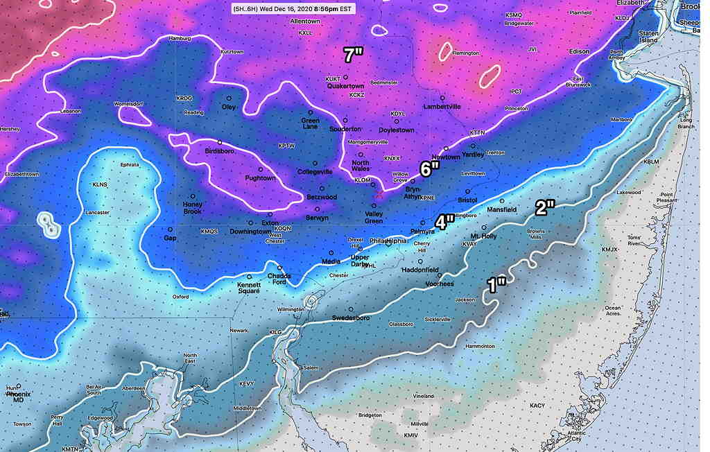
Here are some of the official snow totals—

from Wednesday night…
Wed 10:58 PM Update— The new GFS model just became available. It’s somewhat of an outlier, but it shows an additional 4-5 inches of snow later tonight in the Blue Bell area! I guess we’ll see tomorrow.
I thought I might want to wait for the GFS data to become available to make a call on additional snow tonight, but there’s enough agreement with the available 00z models tonight to make that call now.
It appears that the sleet, freezing rain and rain will continue and change back to snow. Some of that precipitation will compact down existing snow from this afternoon.
However, the new models (HRRR, RAP, NAM, NAM-NEST, HIRESW NBM) show at most, about 1/2 inch to under 2 inches additional accumulation in the PHL area and the immediate surrounding north and western suburb.
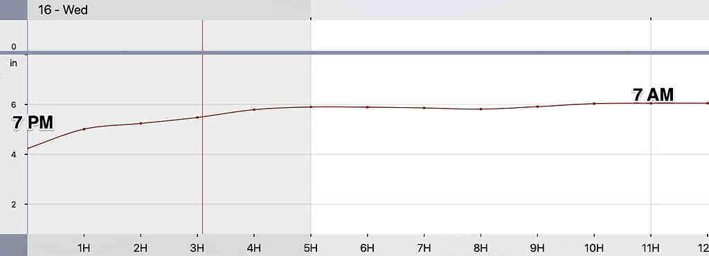
Below is the snow depth meteogram for Blue Bell, which pretty much captures the trend for additional snow and compaction for the region tonight (and it’s just a bit high already.)
Snow ends before 7 AM with perhaps some scattered snow showers in the morning. Cold and windy. A frozen tundra!