Saturday looks to be sunny and dry with warmer temperatures and less wind. High 63.
The remnants of a tropical low moving up from the south had been expected to move out to our east, missing us.
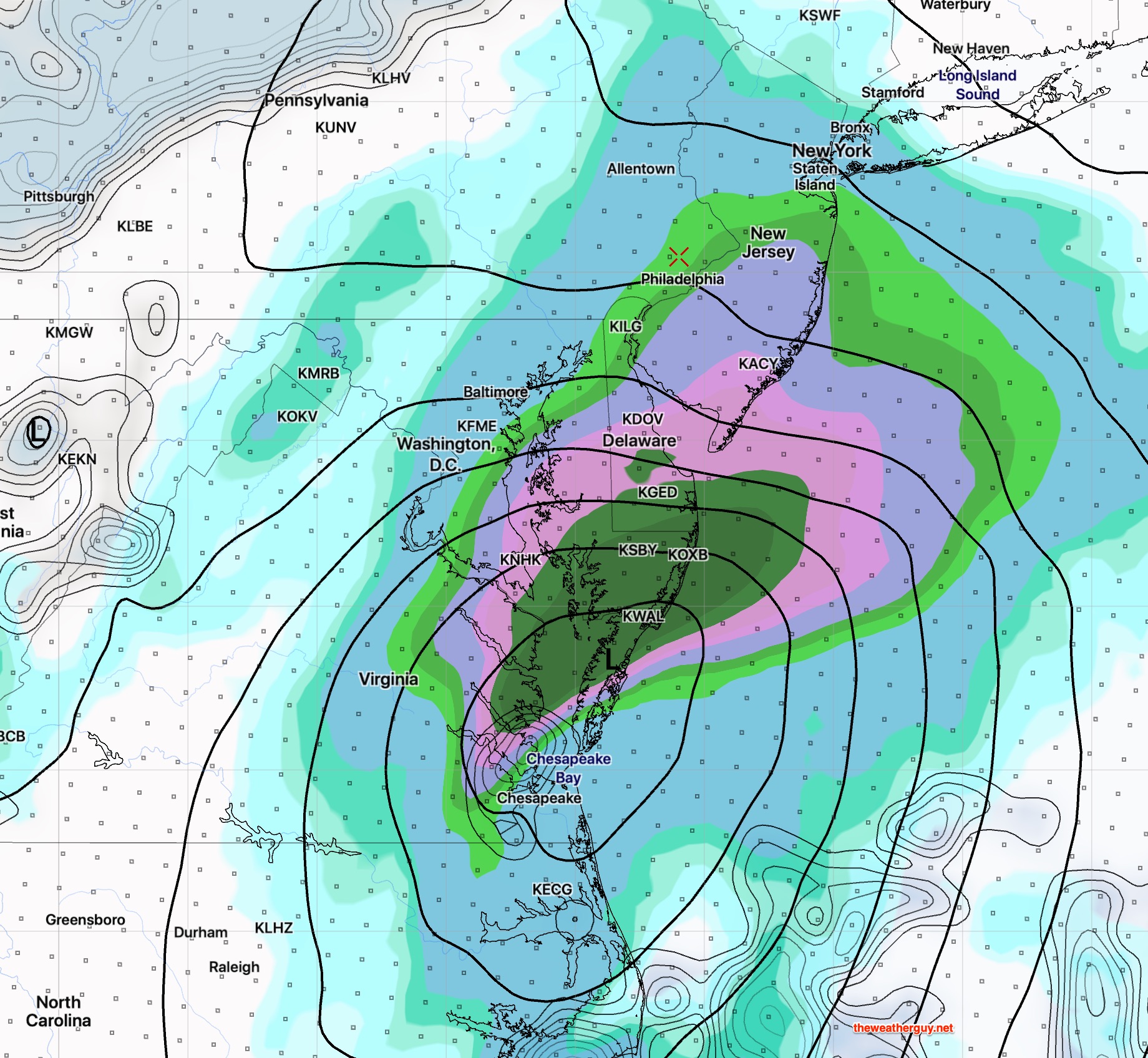
However, recent model runs from the GFS, CMC, ECMWF (European) and NAM show the low to hug the coast, then move eastward, with precipitation just making it into Philadelphia on Sunday early afternoon.
NAM model precipitation/ pressure/cloud forecast for 2PM on Sunday
(The above NAM forecast has precip slightly further west than the other models mentioned. Its QPF of about 0.40 inches water may be overdone.)
Sunday looks to be cloudy with the chance of light showers Philadelphia and westward and heavier rain in NJ. High 60.
There’s still uncertainty with the Sunday system. I’ll update this evening.
The models did well with today’s (Wednesday) rain. I hope they’ll continue to do as well predicting similar storms this winter.
Following the exit of the coastal low today (Wednesday) and the passage of a cold front this evening cooler air moves in.
Cool and windy weather for Thursday and Friday. Considerable cloudiness for Thursday and it will look more like November than mid-October.
Saturday looks to be sunny and dry with warmer temperatures and less wind.
For Sunday, another coastal low, advancing from the south, had been expected to scoot out to the east on Sunday missing us. Today’s models are suggesting this low may be close enough on Sunday to give us clouds and some showers, especially in NJ.
The long range continues to show cold weather just prior to Halloween.