A brief update. The first of this morning’s models are coming in. Like last night, the trend is for the main area of heavy rain to move in a bit later— between 4:30 and 6 PM. Winds will be increasing.
The other trend is for less severe storm parameters. “Vertical shear” has reduced with this model run from the extreme values forecast yesterday.
The scattered showers we’re having in the morning now were predicted and won’t last.
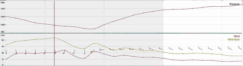
Updated Mon 12:59 PM — Another of this morning’s models, the HIRESW, showing peak wind gusts just about now. It still has wind gusts in excess of 60 mph. Click on image to enlarge:
HIRESW Meteogram showing peak winds above 60mph occurring about now
Updated Mon 11:49 AM — Reduction in predicted wind gusts.
This morning’s models have further reduced peak wind gusts. The outrageously high gusts predicted yesterday and last night have been negated by this morning’s models. All models had over-predicted these wind gusts.
Current forecast for gusts 40-50mph is more like it.
Thunderstorms will form and move through between 12 and 3 PM. The actual cold frontal passage will be about 3 PM.
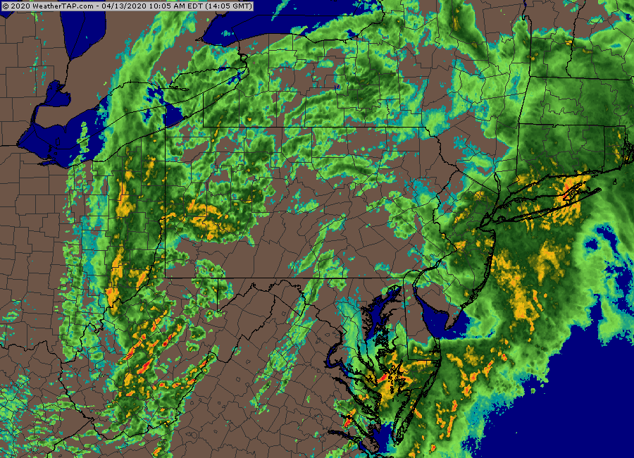
Here’s current radar at 11:35 AM—
Current Radar Loop, courtesy WeatherTap.com. Click on image for larger view.