Update Sat 12/24 6:31 PM — Forecast for Sunday below on track. A significant warming trend towards the end of the week with some rain next weekend.
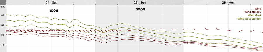
Update Sat 12/24 8:12 AM — Still expecting considerable periods of cloudiness (with some sun) today, as instability develops and and areas of vorticity revolving around the deep low pressure system pass through the area. Cold and windy.
The latest models suggest some sun with periods of clouds as well on Sunday. More sun Sunday than today. Winds diminish in the afternoon.
A warmup expected next weekend with some rain.
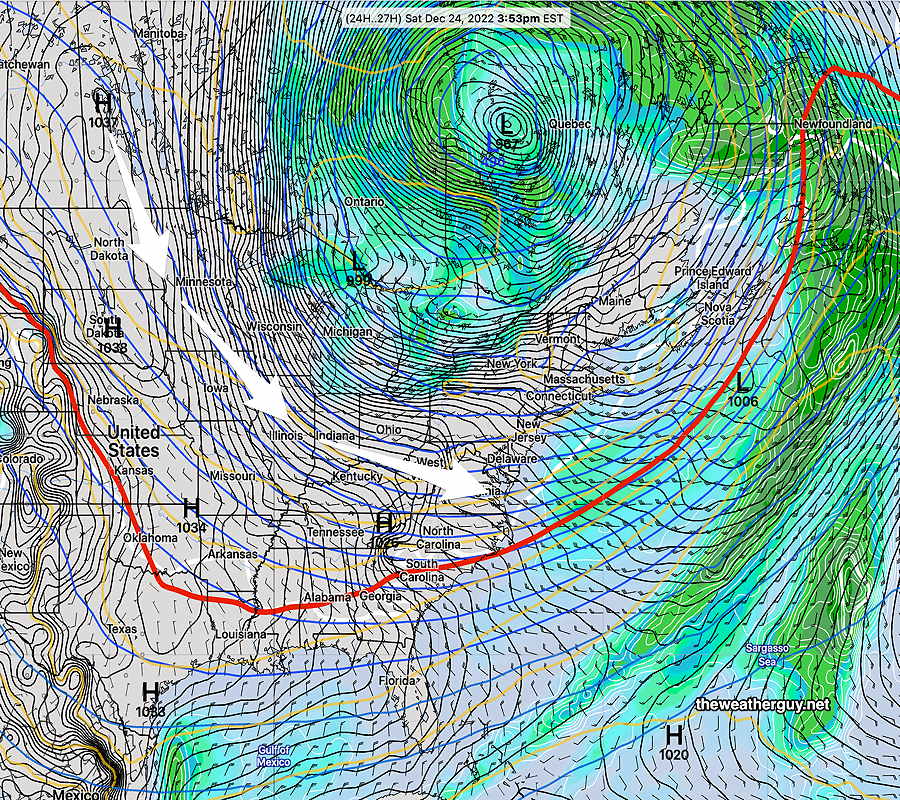
The very cold weather for this weekend has been well-advertised. The circulation around the intense low that is now in Canada will continue to affect our weather this weekend.
Saturday
A mix of sun and clouds. Very windy. Instability cloudiness may be considerable at times, especially northwest of the city.
High temperature 16.6º sd 2.6º NBM model – for location Blue Bell, PA (high spread of 2.6º due to uncertainty in cloud cover)
Sunday
Mostly sunny. Less windy in the afternoon. Continued very cold.
High temperature 25.0º sd 1.7º NBM model – for location Blue Bell, PA
Winds