
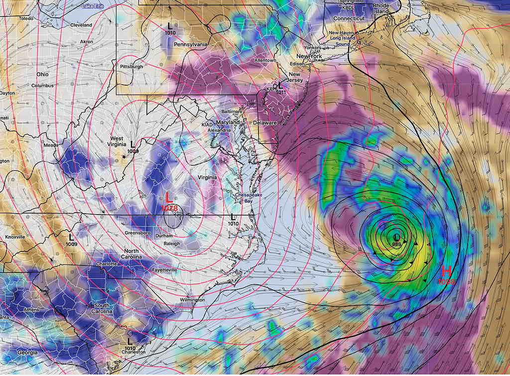
Fri 12:38 PM — Some of this morning’s models are beginning to show a more westward loop in Henri’s track, possibly affecting our area more directly as it loops westward. An evolving forecast…
Fri 7:00 AM— Based on comparison of current water vapor imagery and model forecasts, it appears that the upper air low is further south than forecast by the models. This could have the effect of pulling Henri closer to the coastline. Just a conjecture. As for Friday as a ‘test forecast’, last night’s HRRR and NAM did the best with the radar location of this morning’s light showers.
The coming weekend weather will be influenced by an upper air low pressure system, the residual moisture of Fred, and the moisture outflow of tropical storm (possible hurricane) Henri. The result will be a complex forecast situation based on an unstable atmosphere with periods of sun, clouds, showers and thunderstorms.
Sky conditions will be similar to today (Thursday) with periods of sun, periods of dark clouds. The big unknown will be the exact timing and placement of showers/thunderstorms.
With daytime heating and weak non-specific triggers, the best bet will be that most of the shower activity will be in the afternoon and evening, when thermal instability is at its highest.
PWAT values will be in the high 1.9” to 2.1” range, meaning that any slow moving storms can drop significant rainfall in a short period of time.
Friday will be a good test of the models with this setup. Friday, the upper air low will trigger the development of a weak surface low just to our south. The models have showers moving in mid to late morning and lasting into the early afternoon. (From Philadelphia and south) We’ll see how things play out tomorrow.
Henri may strengthen from a tropical storm to a hurricane but is still expected to stay far enough off the NJ coast to only bring indirect effects of surf/wave effects at the shore and outflow moisture enhancing the already unstable atmosphere in place here. Of interest is that the ICON model has been showing the possibility of a jog westward and looping track as it gets to the eastern end of Long Island.