ElSA

Fri 08:48 AM Forecast Review — The heavy rain had a sharp westward cutoff, as eventually predicted by the models late afternoon and evening yesterday.  Here’s radar image from 4 AM  showing the the heavy rain had a strong east-west cut off—
Radar 4 AM


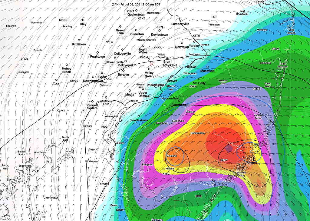
Updated on Thu 10:46 PM Tonight’s models have reduced the amount of rainfall and moved the heavy rain further eastward.


Updated on Thu 7:30 PM highlighted below

The latest Canadian Regional GEM model captures the sharp western cutoff in expected heavy rainfall that several afternoon models are showing—

Canadian Regional GEM rain forecast captures the sharp cutoff in heavy rain just west of the city. (Click on image for a larger view.)

The latest ICON model, which did very well with last year’s tropical storms, has the heavier rain further westward.

ICON model total rainfall. (Click on image for a larger view.)

Updated on Thu 5:59 PM highlighted below

The afternoon model runs just are becoming available. The HRRR, the GFS and the HREF have a sharper cut-off of the heavy rain just west of Philadelphia with the heaviest rain most similar to the Model Blend NBM graphic below in the original post..


Updated on Thu 1:54 PM highlighted below

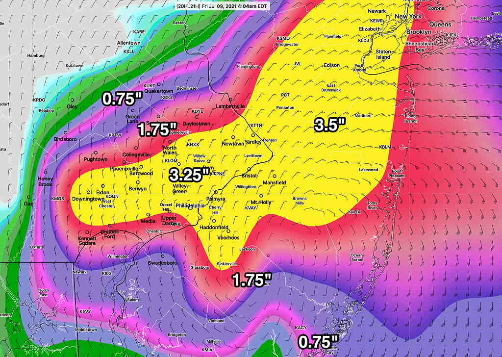
With the more westward track of the storm, the latest GFS has moved in the direction of the ICON and HREF models with 1.5-3.5″ of rain, extending into the Philadelphia area.

GFS model from 12z showing accumulated rain forecast by Friday morning.

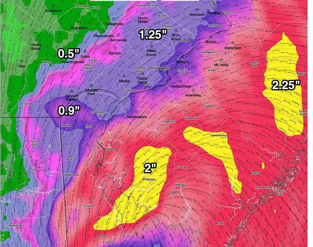
The latest ICON model (which did very good with last year’s tropical systems) has less rain accumulation-

ICON model accumulated precip forecast from 12Z today. (Click on image for a larger view.)

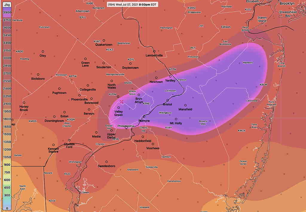
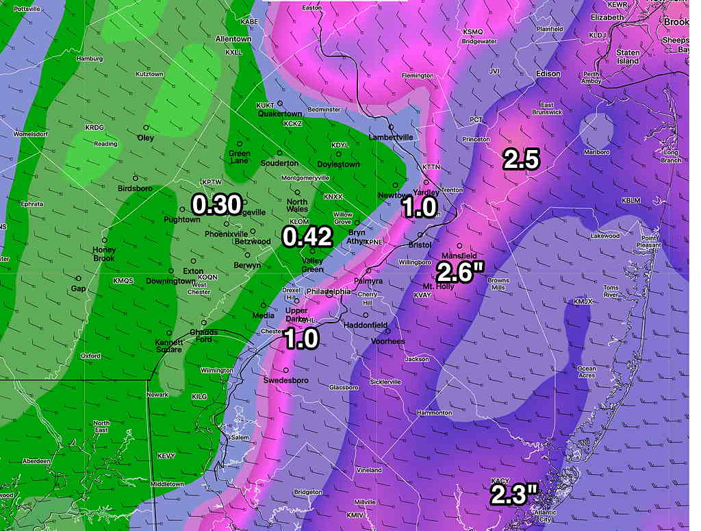
Model Blend (which underestimated rainfall with last year’s tropical systems)

NBM (Model Blend) total rain forecast (Click on image for a larger view.)

see my Elsa post from Monday

A cold front is approaching from the Great Lakes and a pre-frontal trough will move through Thursday afternoon. Showers and thundershowers expected after 4 PM. Most of the thunderstorm activity will be expected in the far northwest areas, with heavy rain showers later this afternoon and evening in the Philadelphia area.

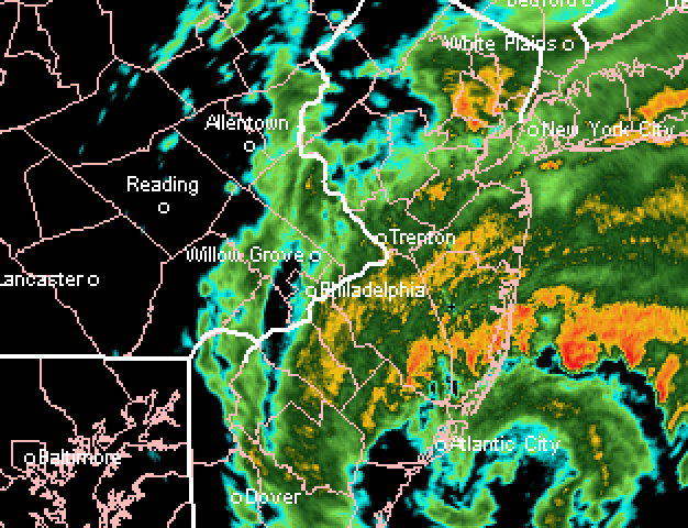
The remnants of tropical storm Elsa moves in later this evening and will affect us during the night time hours. The main effects of this storm will be high precipitable water and heavy rain. Not much wind expected (30 mph gusts), mostly at the shore. The storm exits early Friday morning.

Rainfall when it ends will be in the 1.5-2.5 1.5-3.5 inch range. Exact placement of the heaviest rain a challenge. The GFS keeps much of the heavy rain in NJ while the higher resolution models and the ICON have it overspreading the Philadelphia area. The Canadian GEM has the heaviest rain near Philadelphia! I’m leaning towards the heavy rain making it into Philadelphia.

GFS 1 hour 3 hour precip forecast for 3 AM Friday morning. (Click on image for a larger view.)
HREF precip Forecast for 4AM Friday showing heavier rain into the Philadelphia suburbs. (Click on image for a larger view.)

THUNDERSTORMS WEDNESDAY

Wed 09:39 PM — The westward path of Elsa, as indicated in Monday’s post (“If-Else(Elsa), then Rain”) continues to hold.   Latest models have 1.5-2.5 inches of rain for areas in Philadelphia and NJ.  More info tomorrow… 
Wed 05:55 PM Forecast Comment —  So why little thunderstorm threat today vs yesterday?  Despite high predicted CAPE and hugely negative Lifted Index values, there is little vertical upward motion trigger today in the upper atmosphere.   Wind flow in the upper half of the atmosphere is slightly anticyclonic today, resulting in sinking airflow compared to yesterday’s cyclonic flow.    Some widely scattered storm activity is possible, but nothing like Tuesday night.    

Updated 1:08 PM highlighted.
This morning’s models have the strongest vertical motions and dynamics from Allentown northward. While some scattered storms are possible in this area, the heaviest activity will be in the Allentown area.

Another quick post- Last night’s models show significant instability and CAPE values between 5 PM and 11 PM Wednesday evening. Thunderstorms, heavy to severe, will likely develop again this evening from 5 to 11 PM. (GFS timing shows peak about 10 PM)

The NBM and GFS keep the heaviest activity to the north and west, but the higher resolution models forecast some impressive numbers in our area. Here’s the latest RAP model—

RAP model CAPE at 9 PM. (>3900!!!!) (Click on image for a larger view.)

RAP model Lifted Index at 8 PM (-9!!!) (Click on image for a larger view.)