
Updated Forecast Cold front passage delayed. Rain may linger into Friday morning, changing to snow flurries.
As mentioned in my updated post last night, the trend has been for the cold front to move through later and later. The model forecast has moved the cold front passage later, from 1 AM Friday morning to about 4-5 AM Friday (GFS model) as low pressure tries to develop when the front hits the coastline. See the GFS below—
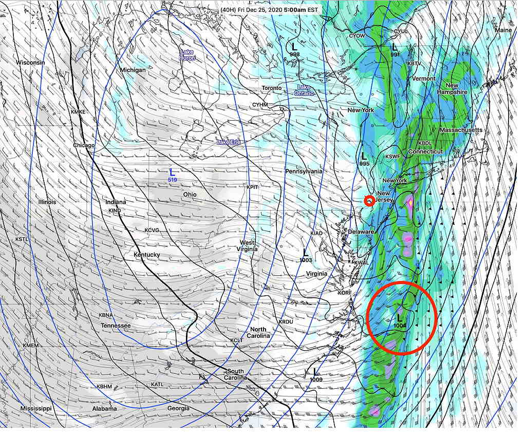
(This low pressure development along the coast was first suspected to be possible several days ago, but the models until today did not show it.)
The models are predicting high wind gusts of 50-60mph during the night time hours and cold front passage.
Rain will start as early as 4 PM Thursday afternoon and become very heavy during the evening. A total QPF of 1.5-2 inches of water is possible by Friday morning.
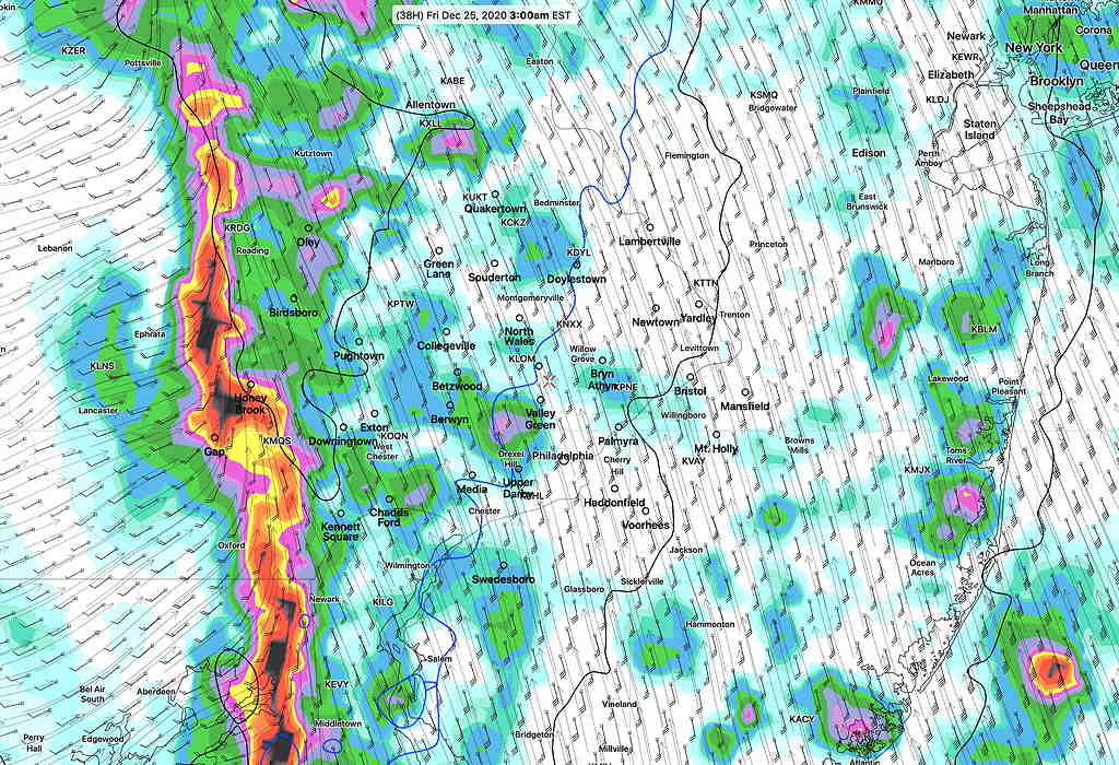
The NAM-NEST suggests possible convective (thunderstorm) activity as the front moves through—
The exact end time of the precip has become less clear as there are some differences in timing of the frontal passage as well as the degree of low pressure development. I would not be surprised if the low pressure system shows greater development.
The NBM (model blend) has picked up on this low pressure development and keeps a forecast of rain and then snow flurries lasting into Christmas day.
High temperature Friday will occur in the morning and fall during the day. Friday will be cloudy, cold and windy.
With the front slowing down, I expect further changes in the forecast. Stay tuned.