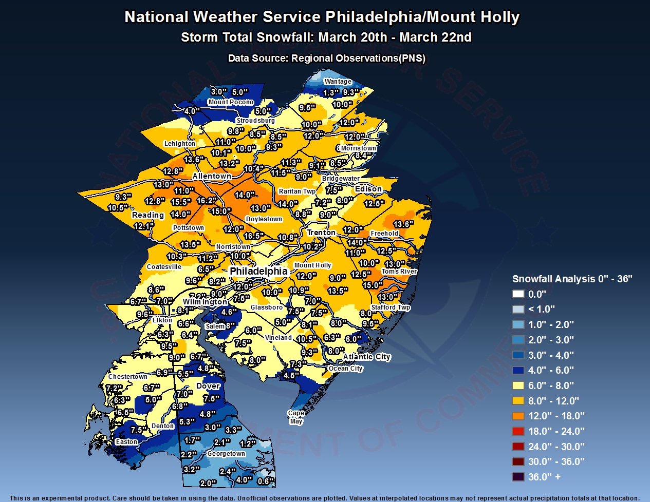
My previous post included the link for the official snow totals. I always like to evaluate my forecast to improve on future forecasts.
For the immediate PHL area, snowfall was between 7-11 inches and areas somewhat further north and west, totals approached 15 inches.
With my call of 4-7 inches with an emphasis on “7 most likely”, my forecast fell short. So what happened?
Official QPF measured at the airport yesterday was 1.06 water, somewhat higher than the 0.87 predicted by the NAM and higher than the GFS. But overall the models did well on QPF. (The actual snow total for just Wednesday was 6.7 inches at PHL airport, according to the NWS.)
My emphasis on solar insolation through clouds lead my forecast astray. Had it been January, I would have predicted 8-10, which I mentioned in several posts. So I learned yesterday that heavy snowfall rates trump solar effects, even in late March.
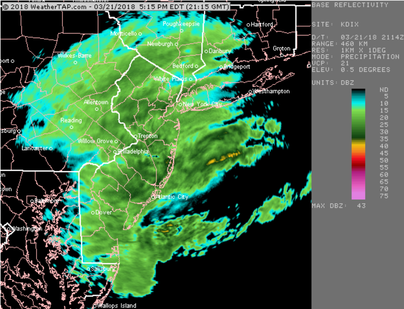
While the models did well on QPF, they did less well on wind. That was lucky for our region. Temperatures were predicted well.
Mesoscale banding set up northwest of the city and snowfall was heavier in those areas.
I’m ready for Spring!