Quick Snow Update 2PM

Well, the snow happened.  Current short range forecasts  (HRRR model ) show it ending in the Philadelphia and immediate surrounding areas between 4 and 6 PM.   An additional 4 inches of snow is possible in some areas near PHL from 2 PM until ending.

Here’s a doppler radar summary depiction of storm total QPF that has already fallen with this storm. (Water value in inches.)   It shows the precipitation maxima locations, which with this storm is not the same as the snowfall total maxima locations–  areas with the highest QPF in this storm likely had much of the early precip as rain.
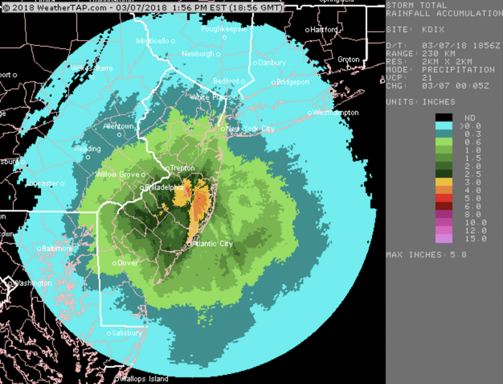
Dopple Radar summary
Doppler Radar Storm precipitation summary, courtesy of WeatherTap.com


There’s still more snow to go.

[su_note note_color=”#ebf2d9″]One thing that the forecasts got wrong (luckily) was the winds and wind gust forecast.  The winds have been extremely light, avoiding the power line issues.  Hopefully it stays that way.  Current GFS LAMPS forecast has only light winds with no gusts tonight.  That said, wind forecasts are often  the least accurate part of a forecast. [/su_note]

SO WHERE’S THE HEAVY SNOW?

Here, just northwest of the city limits, the precipitation has changed to rain with a pause in the action.  A lot has to happen to get to snow totals that the models have forecast!  Perhaps things have been a bit over-forecast?

This morning’s GFS model continues with the same scenario all the models have been forecasting; heavy precipitation with dynamic cooling to allow temperatures to drop and accumulations to occur.

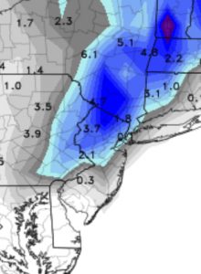
HOWEVER, the GFS Kuchera snow algorithm makes this storm a bust—

Snow totals based on Kuchera
Latest GFS Snow totals based on the Kuchera algorithm!

As mentioned last night, I’m not big on the Kuchera snow algorithm; it tends to seriously underestimate snowfall in past storms.  (Last Friday’s storm had the Kuchera algorithm forecasting NO snow!)

Radar trends show a significant increase in precipitation rates in NJ, rotating westward into Pennsylvania.    Despite all forecast parameters as snow, things have to change soon for this forecast to not be a bust.  And as I type this, precipitation has changed back to snow!  So let’s see what happens.

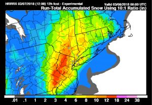
BTW, here’s the latest HRRR (High Resolution Rapid Refesh) experimental forecast snow totals—

HRRR experimental
Experimental HRRR forecast snow accumulation from 12Z today