Philly Weekend Weather Forecast

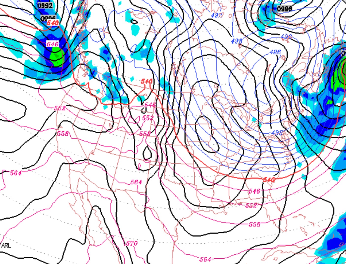
The deep dip in the jet stream today will be reinforced with another shot of cold air on Saturday.

GFS Forecast Saturday afternoon

The polar front moves through before daybreak Saturday morning, the winds pick up and temperatures stay steady during the day.  Mostly sunny, some clouds.  High 19.

Due to the winds, Saturday may feel like the coldest day of the weekend, but in terms of temperature, the cold air will be entrenched Sunday, and high temperatures may just hit 15!   Less windy on Sunday with partly sunny skies.

Storm outlook:

A storm approaches from the south late Monday.  Light snow late Monday afternoon, will change  to sleet and freezing rain, then rain likely by Tuesday morning.   Quite mild by Tuesday, with heavy rain expected.   Possibly a brief snow shower late Tuesday night as temperatures drop again.   An upper air disturbance may bring a period of light snow on Wednesday.

Philly Weather Outlook

Very cold weather for Thursday and Friday, becoming extremely cold Saturday and Sunday as a polar vortex dives south over our area.

Something to keep an eye on is a deep coastal storm expected to arrive in the Tuesday to Wednesday timeframe. This could start as a bad ice storm Tuesday with an uncertain transition to sleet snow or rain.  Stay tuned.

Weather Update

The heavier snow came in  this evening.  Only the model runs within the past  18-24 hours really captured the somewhat correct QPF values and only early this morning did the models show the temperatures being above freezing in the late afternoon.

So this snow went from a “winter storm warning” to an “inch or so, mostly on grassy surfaces”.

Look for the infamous “polar vortex” to return for Valentine’s Day.